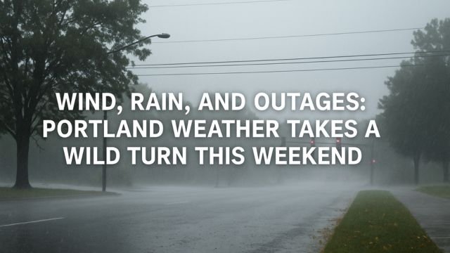
When it comes to fall in the Pacific Northwest, Portland weather never holds back. This weekend proved exactly that. A strong Pacific storm rolled in on Saturday, October 25, bringing with it a potent mix of heavy rain, strong winds, and widespread power outages across Portland, Salem, and the wider Willamette Valley. The setup was classic but intense, and the impacts were real. Trees toppled, lights went out, surf raged along the coast, and snow returned to the Cascades in full October style.
Let’s break down what happened, what’s still happening, and what comes next for Portland weather watchers. This was no minor drizzle, but a real-deal atmospheric river event with teeth.
A Wild Saturday: Wind, Rain, and Rolling Blackouts
By Saturday morning, Portland residents could already feel something brewing. The wind had that sharper edge. Leaves scattered faster, and the sky darkened early. This wasn’t your average autumn breeze. A powerful low-pressure system near the Olympic Peninsula tightened the pressure gradient over northwest Oregon, sending strong southerly winds racing up the Willamette Valley.
Gusts between 35 to 45 mph hit parts of the Portland metro area, while coastal zones saw even stronger blasts between 50 to 60 mph. These winds, paired with soggy soil and peak leaf fall, meant one thing: downed trees. It didn’t take long before utility companies started seeing their outage maps light up.
Portland General Electric (PGE) reported over 20,000 customers without power at peak outage times Saturday afternoon. Pacific Power saw rolling blackouts as well, especially south of Portland into Salem and the I-5 corridor. In some places, the numbers fluctuated quickly as crews worked hard to restore lines while new reports of damage rolled in.
Meanwhile, rain fell in steady sheets, soaking an already damp region. Storm totals ranged from half an inch in Portland proper to over two inches in the higher elevations of the Cascades and Coast Range. The city’s drainage systems struggled to keep up. Leaves clogged gutters and created ponding in the usual trouble spots, like low-lying intersections and curbside dips.
Further east, the Cascades saw their first real taste of winter. Snow levels dropped to around 3,500 to 4,000 feet as colder air followed the storm front. Mount Hood and Santiam Pass recorded up to 10 inches of fresh snow by nightfall. That made for some slick travel conditions over the mountain passes, just in time for weekend traffic and early-season adventurers.
The coast didn’t escape untouched either. Gale-force winds battered the headlands, with storm warnings flashing across marine zones. Waves climbed over 20 feet at offshore buoys, and high surf advisories warned beachgoers to stay far back from logs and jetties. Some locations along the north Oregon coast reported breakers near 30 feet, high enough to cause minor coastal flooding near peak tides.
This was a true region-wide event. KOMO News in Washington flagged similar conditions, with Seattle and the Olympic Peninsula seeing much of the same wind, rain, and snow storylines. The entire Pacific Northwest rode the same atmospheric river highway this weekend.
What’s Next for Portland Weather?
As of Sunday morning, the worst of the wind has passed. The tight pressure gradient that powered Saturday’s gusts is finally easing. But don’t put away the rain gear just yet.
Showers will continue throughout Sunday, keeping roads wet and visibility low at times. Rain totals could reach another inch or more by the end of the day. With the ground already saturated, even moderate wind gusts could still bring down weakened limbs or shift previously stable trees. It’s not over, just less dramatic.
In the mountains, snow continues to fall. Winter Weather Advisories remain in effect for the Cascades, where another 4 to 6 inches of snow could pile up by Monday morning. Travel over passes like Government Camp or Santiam will remain treacherous, with chains or traction tires likely needed at higher elevations.
The early week outlook calms a bit. Monday through Wednesday looks quieter with cooler highs in the low to mid 50s, patchy valley fog in the mornings, and only scattered light showers. It’s a good breather for cleanup and recovery.
But late next week? Another system is already in the sights. Models show a new storm brewing offshore that could bring additional rain and possibly gusty winds to Portland by Thursday night into Friday or Saturday. The details are still uncertain, but it’s clear the fall storm pattern isn’t going away.
Portland weather this time of year lives in cycles. Storms build, sweep through, then give us a brief pause before the next one. This last system reminded us that October is no joke. It also confirmed that we’re now firmly in the active storm season, with all its wet, windy, and wild flavor.
Takeaways for Portlanders
• If you’re still without power, check the outage maps from PGE or Pacific Power. Many crews are working nonstop, but full restoration in some pockets may take time.
• Avoid driving through ponded streets. Even shallow water can hide deep potholes or floating debris.
• If you’re heading over the Cascades, be ready for full winter travel. Check ODOT cams before leaving.
• Coastal travelers, don’t underestimate the surf. Sneaker waves and unstable logs are no joke. Stick to safe paths and stay high and dry.
• Keep an eye on updates from the National Weather Service for hazard warnings, especially as we get closer to the next late-week system.