When you live in a country that gets visited by nearly 20 tropical cyclones a year, you learn to read the clouds, listen for that change in the wind, and keep one eye on the nearest river. This week, the storm everyone was watching made itself known. Typhoon Kalmaegi, locally called Tino, swept across the heart of the archipelago, leaving city streets underwater, ferry passengers stranded at terminals, and thousands of families displaced in its wake. As the center of the storm crossed Cebu, Negros, and nearby provinces, the real threat didn’t come from howling wind, but from how much water the sky could drop in just a few hours.
This was a “flood typhoon” through and through. The kind that finds a weak spot in your drainage, your terrain, your tide schedule. In this post, we’re breaking down what made Typhoon Kalmaegi such a dangerous storm for the Philippines, where the worst impacts were felt, and what’s still at risk as the circulation drifts westward into the sea.
A slow crawl across the Visayas with fast-rising floods
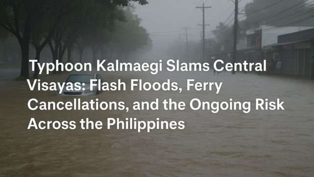
Kalmaegi came ashore early Tuesday near Silago in Southern Leyte. From there, it took a textbook “island-hop” route across the Visayas. It moved through Cebu, Negros, and Guimaras with multiple landfalls. That kind of track slows a storm down, and the slower it moves, the more rain it dumps. Instead of rushing through and being done, Kalmaegi lingered. In places like Cebu City and Mandaue, it felt like someone turned on a firehose over your street and walked away. Within hours, roads became rivers. Cars were floating. People waded waist-deep in brown water to get to safety. In some of the worst-hit areas, families climbed onto rooftops to wait for rescue.
The typhoon didn’t need to be huge to do this. Kalmaegi was compact, but intense. It had tightly wrapped convection, which just means it squeezed out rain in tight spirals. Those spirals parked themselves over certain districts and didn’t let up. PAGASA (the Philippine weather service) raised storm surge alerts for parts of Palawan, Mindoro, and Western Visayas, warning that coastal areas could flood even if the rain paused. Inland, though, it wasn’t the sea rising. It was the rivers spilling their banks, the streets choking on runoff, and the usual canals just not being able to keep up.
The typhoon Philippines communities feared had finally arrived, and it brought all three classic dangers at once: wind, surge, and flood. But in this case, it was the water that ruled the headlines.
Why this storm hit so hard, even without Category 5 winds
When people hear “typhoon,” they usually picture rooftops ripped off and palm trees bending sideways. But Kalmaegi wasn’t about brute-force wind. Sure, gusts hit 180 to 200 km/h in places, but that wasn’t what made this storm so deadly.
The number one factor was rainfall. Kalmaegi’s compact core and slow crawl meant the same provinces got soaked again and again. The terrain didn’t help. The Visayas region has lots of steep, short watersheds. That means rain doesn’t have far to go before it runs into town. Mix that with paved urban zones, and water builds up faster than the drains can carry it away.
The second problem was the sea. Even with the storm mostly over land, onshore winds continued to push sea water toward the western-facing coasts. Areas like Antique, Capiz, and western Negros were at risk of water coming in both directions: from inland floods and from the sea. PAGASA warned of this in their surge bulletins, and while not all zones saw major coastal flooding, the setup was primed for it.
Lastly, Kalmaegi made several landfalls. That interrupted its forward momentum, giving it more time to drop rain. Satellite loops showed how it slowed over the Iloilo Strait, reorganized a little, then kept crawling. Every hour it spent over the islands meant more runoff, more strain on river basins, and more chance for sudden flash floods.
As of Tuesday evening, media outlets like Reuters, AP, and Al Jazeera were reporting two dozen confirmed deaths. Most of them were from flooding, not wind. Cebu province had the most critical impacts, including multiple fatalities, large-scale evacuations, and damage to roads and infrastructure. The NDRRMC (National Disaster Risk Reduction and Management Council) is still updating the official tally. These numbers will keep changing as field teams confirm what happened in barangays that lost power or signal during the worst of the storm.
Airports closed. Ferries stopped sailing. Flights were grounded. As early as Monday, authorities were suspending transport across the Visayas. Some ports were already packed with stranded passengers when the first rainbands rolled in. That’s typical for the kind of storm Kalmaegi was, fast-moving in water impact, but slow enough in speed to halt everything in its path.
What happens now: surge risk, recovery, and the storm’s next move
Even though Kalmaegi’s core is moving out of the Philippine islands, the danger isn’t over. Residual bands still carry heavy rain. In coastal areas west of the Visayas, especially Palawan and Mindoro, storm surge could still threaten low-lying neighborhoods. PAGASA continues to issue bulletins about this.
At sea, the typhoon is moving into the South China Sea, where warm water and minimal shear might give it a chance to re-strengthen. Marine hazards will remain high. Countries like Vietnam will now start to monitor Kalmaegi as it drifts closer to their zone.
For the Philippines, the coming days are about cleanup and verification. Power outages in Cebu and Leyte are widespread, and water services in some areas are damaged or offline. The Department of Public Works and Highways (DPWH) is assessing road damages, while the Department of Social Welfare and Development (DSWD) is coordinating aid to evacuees.
Urban flooding may take a while to fully drain. Even after the sky clears, the ground remains saturated. Any additional showers can trigger fresh flooding, especially in basins already overwhelmed. That’s why it’s important for residents to stay alert even after the eye has passed.
This was a storm built for flooding. Its wind did damage, but its legacy will be the water it left behind. The typhoon Philippines communities endured this week may not have broken wind records, but it tested the country’s flood preparedness in the middle of peak cyclone season.