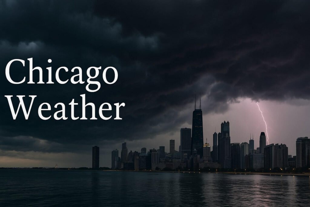
A warm, humid July evening in the Windy City has taken a sharp turn into severe weather territory. As of Friday night, a tornado watch in Chicago has been officially issued and will remain active until 11 p.m. CDT. This alert, labeled Tornado Watch #508, was triggered due to a volatile mix of high moisture, tropical heat, and approaching storm clusters that are more than capable of producing not just strong winds, but also brief tornadoes and very heavy rain. If you live in or near Cook County, or any surrounding counties like DuPage, Lake, or Will, now is the time to be extra alert.
Let’s break down what this tornado watch means, how it developed, what we’re seeing in real-time, and what to expect as the evening unfolds. This post is here to keep you informed in simple language, backed by expert insight but written so anyone can follow what’s going on.
Why is there a tornado watch in Chicago tonight?
The atmosphere over northern Illinois has become unstable. All the ingredients are in place: sweltering temperatures in the high 80s, thick tropical air with dewpoints in the mid-70s, and an advancing cold front slicing through from Iowa. As this front pushes east, it collides with the moist air over the city, lifting it upward and creating strong thunderstorms. It’s like setting a lid on a pot of boiling water and then lifting it suddenly — the steam bursts upward, fast and furious.
What makes this different from an ordinary summer thunderstorm is the spin. A low-level jet stream is injecting enough wind shear to create rotating updrafts, which is where tornadoes can form. The Storm Prediction Center has flagged this area under a “slight risk,” which means scattered severe storms are expected, and while they may not all be tornadic, some could produce dangerous winds or even a quick spin-up tornado.
Real-time conditions and where things stand now
Radar as of 9:00 p.m. CDT is lighting up with a bowing line of storms sweeping eastward toward the lakefront. If you’re in places like Schaumburg, Aurora, or Naperville, you’re likely already seeing lightning flicker and hearing thunder crackle. The main line of storms is moving at a rapid pace of about 45 miles per hour, pushed along by the jet stream and cooler air behind the front.
These storms are not only bringing the potential for tornadoes but also fast, powerful wind gusts. Some segments are bowing forward on radar — a classic signature for damaging straight-line winds. Gusts in the 60 to 70 mph range are possible, especially along I-88 and I-290.
Meanwhile, flash flooding is another major concern. Earlier in the day, parts of the city saw torrential rainfall that soaked the ground. With more storms moving in, runoff could be quick and deep. Low-lying areas like viaducts, underpasses, and portions of DuSable Lake Shore Drive are particularly prone to pooling water. NBC Chicago already reported earlier crashes and power outages, and city crews have been clearing drains in preparation for more water.
What to do and how to stay safe
This is the time to have a plan. If you’re at home, make sure your phone is fully charged and that you have a way to get alerts. If you’re out and about, get to shelter. Festivals, ballgames, and Lollapalooza set-up should be wrapping up quickly. The key here is that tornado watches mean conditions are favorable, not that a tornado has formed yet — but when they do form, especially after dark, they can be harder to spot and faster to touch down.
If a tornado warning is issued for your area, move immediately to a small, windowless interior room on the lowest floor of your building. Basements are best. If you’re in a high-rise, go to the middle of the building and avoid corners and glass. Helmets and heavy blankets can help protect your head from debris. Don’t wait for sirens — if your phone buzzes with a warning, act.
Also, avoid driving during peak storm hours. The window from 8 to 11 p.m. is the most active based on current storm models. Roads like the Kennedy Expressway and Eisenhower are known to flood quickly. Water can hide debris or even sinkholes. As the National Weather Service reminds us, “turn around, don’t drown” — it’s not worth the risk.
What’s next after the tornado watch expires?
Once the storms pass through, conditions should begin to settle down overnight. Humidity will still linger, and there’s a good chance for patchy fog by morning. But the weather isn’t fully done with us yet. Saturday holds another slight risk of storms, especially east of I-55, where any lingering boundary could trigger new afternoon development. That said, Sunday looks much quieter. Cooler, drier air will push in from the north, and we’ll finally catch a break from both the heat and the storms.
In the bigger picture, Chicago has been on the edge of an active weather pattern for days. From early week heat warnings to late-week flash flood watches, the region has been riding a rollercoaster. The current tornado watch is just the latest twist — but one that we should take seriously. Storms this summer have shown they can pop up quickly and cause serious trouble in a short time.
So for now, stay inside, keep an eye on trusted local radar and alerts, and don’t take chances with tonight’s weather. Whether it’s high winds, flash floods, or rotating storms, this evening carries real risks. The tornado watch in Chicago means it’s time to stay alert, not panic, and be ready to act if needed.

