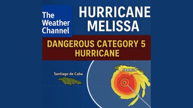
When a major storm like Hurricane Melissa builds toward Category 5 strength and begins its slow crawl toward Jamaica, every minute counts. People are not just looking for headlines. They are refreshing trackers, watching surge maps, comparing wind fields, and trying to make sense of what’s real versus what’s noise. That’s where the Weather Channel steps in. For millions, it’s not just a TV station or a website. It’s the default tool for urgent weather awareness, whether they’re pulling it up on their phone at midnight or letting it run on the screen while packing an emergency bag.
But what is the Weather Channel, really? Behind the scenes, it’s actually two different arms. One is the TV network, owned by Byron Allen’s Allen Media Group, where the field reporters, radar loops, and breaking alerts come from. The other is the digital side, known as The Weather Company, which runs the website weather.com, the Storm Radar app, and everything you can tap, scroll, or swipe. That digital side was sold by IBM to Francisco Partners in early 2024, and it’s where most people get their interactive maps and live trackers during hurricane season.
When you go on weather.com today, especially during something as serious as Hurricane Melissa, what you’re really getting is a full toolkit. There’s the forecast cone right at the top. This shows the National Hurricane Center’s projected path, with clear timestamp updates. But it doesn’t stop there. You’ll also find graphics showing the wind probabilities (your chances of getting tropical storm or hurricane-force winds), storm surge outlooks, rainfall estimates, and even spaghetti models that show what different computer models think the storm might do next.
For Melissa, the Weather Channel’s map hub is packed. It’s updated every few hours as new data rolls in. It tells you not just where the center of the storm might go, but how far out damaging winds might stretch. For example, even if the eye doesn’t hit your town, you could still face hours of pounding surf, flooding rain, or power-killing gusts. On top of that, their blog-style live updates bring in on-the-ground details like airport closures, emergency curfews, and local evacuation orders. These updates give you the edge when seconds count.
What makes the Weather Channel’s hurricane coverage really stand out is how it brings official National Hurricane Center data to life. It doesn’t try to replace it. Instead, it turns those dense forecasts into fast visuals you can understand at a glance. The rain swath map? That’s where you look to see if your area is at risk of flash flooding. The wind field graphic? That tells you if your roof is in trouble or if it’s just a blustery day. The surge graphic? That could mean the difference between riding it out at home or getting inland while roads are still open.
The team also adds helpful layers like ocean heat content and wind shear maps. These tools don’t mean much to the average person at first, but once you learn what they show, they help you understand why some storms explode in strength while others fizzle. For Hurricane Melissa, those maps explained how the storm hit a pocket of extremely warm water with low wind shear, creating the perfect fuel for rapid intensification.
Right now, the Weather Channel’s hurricane hub clearly states that Melissa could become Jamaica’s strongest landfalling storm since records began. They’re using language carefully, citing the NHC, and backing it up with data. They’re also staying aligned with other reputable outlets like Reuters, CNN, and the Associated Press. Everyone’s saying the same thing: the wind, rain, and surge from this storm are going to be catastrophic, especially for Jamaica’s eastern and southern coasts.
One of the Weather Channel’s biggest strengths is that it provides everything in one scroll. You don’t need to jump between a dozen tabs to find what matters. The forecast cone, wind risk, surge threat, rain totals, and model spread are all right there. Their spaghetti plots, while often misunderstood, are helpful for spotting the range of possible outcomes. Still, it’s always best to rely on the official cone when making personal decisions.
The site also does a solid job of balancing national maps with local context. They often include embedded feeds from local weather services, news agencies, and emergency management offices. That’s important because no matter how sharp their maps are, evacuation zones and shelter info are decided at the local level. The Weather Channel helps you get the big picture, but it’s your city or island government that tells you when it’s time to move.
The TV side, while separate, is a great companion during landfall. Field reporters are placed in the most dangerous spots. They’re not there to dramatize, but to show real-time impacts like rising water, sideways rain, or downed power lines. Meanwhile, the main studio runs radar loops and updates from the NHC as they come in. The TV coverage and the website work best together. One gives you a picture, the other gives you precision.
In terms of accuracy, the Weather Channel often promotes its track record with ForecastWatch, which named it the most accurate U.S. forecaster over several years. That metric is based on temperature, precipitation, and storm path data from thousands of locations. But for tropical systems, the National Hurricane Center remains the final authority. The Weather Channel’s job is to distribute and visualize those forecasts better than anyone else. In Hurricane Melissa’s case, they’re doing just that.
For anyone tracking this storm today, the best way to use the Weather Channel is as follows:
- Start with the cone. It shows where the center might go over the next 48 hours.
- Check your wind probabilities. See the percent chance that your town sees damaging winds.
- Look at the surge and rainfall maps. These highlight the flooding risk and where the worst of it might fall.
- Watch the live blog. That’s where you’ll get news about shelters, curfews, closed roads, and flight disruptions.
- Flip on the TV stream if you need visuals. Seeing the storm hit live might be the nudge you need to take action.
Melissa is a monster. It’s moving slowly, packing violent wind, and dragging heavy rain across high terrain. The Weather Channel is doing what it was built to do — bring fast, clear, data-backed forecasts to millions. If you use their tools wisely, you can stay ahead of what’s coming and protect yourself and your family. Their maps, their apps, and their updates are more than just graphics. They are lifelines in a time when seconds matter.