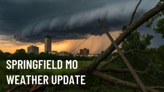
Springfield MO weather turned chaotic Sunday afternoon as a potent line of thunderstorms surged through the Ozarks, leaving behind mangled trees, widespread power outages, and a lingering sense of unease. What started as a warm, sticky late-June day ended with emergency crews scrambling, roads blocked by fallen limbs, and over 30,000 homes without electricity. Now, as the city cleans up the debris, questions swirl about what caused such intense wind damage, how rare this event truly was, and what the next 24 to 48 hours might bring.
Let’s break it all down in plain language, mixing real-time observations with meteorological insights, so you know exactly what’s happening with the Springfield MO weather and why it matters.
Springfield MO weather snapshot: What hit us and why it hit so hard
By mid-afternoon Sunday, radar out of the National Weather Service Springfield office started lighting up with a distinct squall line — a fast-moving wall of thunderstorms formed over eastern Kansas. These systems are notorious for their ability to compress massive amounts of wind energy into narrow corridors. As it reached the Missouri border and accelerated toward the Springfield metro, wind gusts pushed between 70 and 80 mph. That’s nearly hurricane strength, and it showed.
Images from KY3 and local residents captured what those gusts did. Massive tree limbs snapped clean, streetlights blown sideways, entire rows of fences flattened. One of the highest recorded gusts was a staggering 79 mph at Springfield-Branson National Airport. Pressure dropped fast as the line crossed, enhancing the winds and helping transfer energy straight to the surface. It was a perfect setup for chaos, and Springfield got the full brunt of it.
These weren’t tornadic winds, but straight-line, high-velocity bursts caused by downbursts and outflow boundaries. What made this especially dangerous was timing. Most folks were either wrapping up weekend errands or getting ready for the workweek ahead, and the system raced through so quickly there was little time to respond. Add to that saturated grounds from earlier rains and you’ve got the perfect recipe for uprooted trees and snapped poles.
The toll: Damage, outages, and Monday’s messy cleanup
City Utilities of Springfield reported over 37,000 customers without power at the peak of the event. Crews worked through the night, but as of early Monday morning, thousands remain in the dark. Intersections are still flashing red or completely offline, and authorities remind drivers to treat them as four-way stops. Damage assessments continue, with Greene, Christian, and Webster Counties reporting the most widespread issues.
Many homes suffered superficial roof damage, mostly shingles and gutters ripped away by gusts. In some neighborhoods near Battlefield and Republic Road, fences were ripped from posts, while near Strafford, a barn collapse was reported. Fortunately, despite the intensity of the Springfield MO weather, no major injuries have been confirmed. That’s likely thanks to early warning alerts and people heeding the forecasts.
While the focus has been on wind, flooding also crept into the picture. With rain totals between 1 and 3 inches across various counties, low-water crossings in rural areas like the Finley and James rivers quickly became impassable. Flash flood advisories lingered well into Sunday night, especially in Wright, Texas, and Howell Counties.
What’s next for Springfield MO weather? Still stormy, but relief is on the way
The atmosphere remains unstable today. As of Monday morning, temperatures are climbing into the mid-to-upper 80s, with dew points stuck in the high 60s. That’s a sticky, storm-ready setup, and meteorologists are keeping a close eye on the next round of convection expected this afternoon. Another batch of storms could spark up by 2 or 3 p.m., especially just east of Highway 65.
This next round isn’t expected to pack the same punch as Sunday’s squall line, but damaging wind gusts, brief heavy rain, and lightning remain concerns. The Storm Prediction Center has placed Springfield and surrounding counties under a marginal risk category — not the highest level, but a signal that conditions still support severe weather.
By Tuesday, a weak front should move through, drying things out. Highs will dip slightly to around 86 °F with more sunshine, lighter winds, and less humidity. Wednesday and Thursday look similar, setting up for a quieter approach to the Fourth of July holiday. But Springfield MO weather rarely stays calm for long in summer, and long-range models hint at a return to storm chances by Friday evening.
How to stay safe after the storm
Even as the skies clear, Springfield residents are urged to be cautious. Here’s what local officials and emergency services are recommending:
- Assume every downed wire is live. Don’t try to move or touch any lines, even if they seem dead. Wait for utility crews.
- Watch for flooding. Low water crossings that were dry this morning may not stay that way if another round of storms hits.
- Be alert to falling limbs. Many trees were weakened in Sunday’s winds. A strong breeze could still bring down loose branches.
- Stay informed. Make sure your phone is charged, weather apps are updated, and you’re subscribed to local emergency alerts.
- Help out neighbors. Those without power or with limited mobility may need an extra hand or just someone to check in.
In all, Sunday’s Springfield MO weather event wasn’t just a fluke — it was the result of the kind of high-energy atmospheric setup that makes summer in the Midwest both beautiful and dangerous. From blue skies to blackout in under an hour, the shift was sudden and severe. Now, as the city recovers, we’ll be watching radar closely and updating you as the story evolves.
CycloneRadar will continue to monitor the developing conditions and provide real-time updates as needed. Stay safe, Springfield.