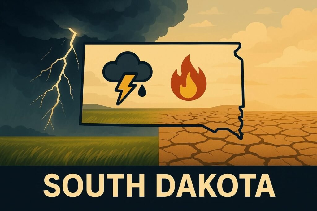
It’s the kind of week where South Dakota wears all her moods at once. Sun glints off golden fields in the morning, storm clouds tower by dinner, and the wind carries both the promise of rain and the crackle of wildfire. As July unfolds, this wide-stretched Plains state is dealing with more than just warm weather. There’s active storm risk tonight, rising heat mid-week, stubborn drought in the west, and fresh road advisories for anyone hitting the highway ahead of Independence Day. Whether you farm corn near Brookings or plan a hike in the Black Hills, this is the week to stay alert. Let’s dig into the big picture and help you navigate the latest conditions across South Dakota.
Storms brewing, skies shifting
The big headline today? Severe thunderstorms are on deck across much of eastern and central South Dakota. Forecasters are tracking a potent upper-level wave moving in from Wyoming, dragging moisture and instability with it. Models show CAPE values climbing near 2,000 J/kg east of the Missouri River, paired with just enough wind shear to organize storms into dangerous squall lines. These won’t just be rumblers with lightning. Expect large hail, damaging wind gusts near 60 mph, and a low—but not zero—chance for a brief tornado spin-up around areas like Watertown, Brookings, and Mitchell.
If you’re in Sioux Falls, the window for active weather starts late afternoon and runs through midnight. Local meteorologists are urging folks to monitor mobile alerts, especially since some of these storms could develop quickly and strike after dark. That means potential for flash flooding in low-lying areas and poor visibility for anyone driving on I-29 or US-14 during peak evening hours.
And this isn’t just a one-night event. South Dakota’s weather pattern this week remains unsettled. After tonight’s frontal system passes, warmer air surges northward again by Wednesday and Thursday. Highs are expected to push into the 90s across central counties, and dew points rising into the 60s will bring sticky heat back into play. The uncomfortable combination of warmth and moisture could spark more pop-up storms by late afternoon each day, especially near Pierre, Huron, and Chamberlain. The severe risk looks marginal right now, but if any shortwave energy sneaks in, things could escalate fast.
Dry land, smoky air, and a fire season quietly waking
As the east braces for rain, western South Dakota tells a different story entirely. Drought conditions persist west of the Missouri River, with the latest data showing moderate to severe drought gripping counties along the Wyoming border. The ground is cracking, the grass is brittle, and humidity levels are routinely dipping below 30 percent during the day. That’s a textbook setup for grassland fire danger, and sure enough, the National Weather Service in Rapid City has issued High to Very High Fire Danger alerts for the week.
Fire departments in places like Custer, Spearfish, and Rapid City are especially watchful, with crews already responding to a few small lightning-triggered grass fires over the weekend. The Black Hills are particularly vulnerable right now, with pine-covered slopes, hot winds, and almost no recent rainfall. Add to that the return of Canadian wildfire smoke, and you’ve got a real concern for both fire ignition and air quality. On June 30, air monitors in western South Dakota recorded PM 2.5 levels exceeding EPA thresholds, and visibility dropped sharply near Belle Fourche and Deadwood.
If you’re planning a camping trip or a scenic drive, double-check county burn restrictions before lighting a fire, and stay mindful of shifting wind. Smoke forecasts suggest another haze event may drift in by Thursday, especially if wildfires in central Alberta continue flaring up. Sensitive groups—especially children, the elderly, and those with respiratory issues—should limit outdoor activity during those smoky periods.
Travel advisories, flooded fields, and new safety laws
There’s plenty to track on the roads this week too. A full closure is underway on US-385 just north of Custer, where highway crews are rebuilding a stretch of road in a $72 million safety overhaul. That detour adds 30 to 45 minutes for anyone heading toward Pactola Lake or the northern Black Hills. Meanwhile, overnight bridge deck work continues along I-90 near Brandon, with flaggers guiding traffic between 7 p.m. and 7 a.m. Expect delays if you’re moving eastbound.
In the southeastern part of South Dakota, there’s still lingering flood impact from heavy June rains. The Big Sioux River remains near minor flood stage near Trent, where croplands along 240th Street are partially submerged. While water levels are slowly dropping, the threat of flash flooding could return fast if tonight’s storms dump localized heavy rain.
On the public safety front, today marks the rollout of South Dakota’s new expanded “Move Over Law.” Drivers must now move over or slow down for any roadside vehicle displaying flashing amber, yellow, or blue lights. That includes not just police and tow trucks, but also city mowers, trash collection crews, and survey vehicles. Fines for non-compliance have jumped, so give extra space if you see crews along county roads or state highways this week.
Farming through the chaos
South Dakota farmers are riding a weather rollercoaster right now. After solid early-season rain in the east, corn and soybean ratings are holding strong: 70% of corn and 68% of soybeans are rated good to excellent, according to the latest USDA crop survey. But scattered hail from last weekend’s storms caused leaf damage near De Smet and Clark, and now farmers face another potential hit tonight. If hail returns, crop insurers could be busy again before the weekend.
West of the river, drought is taking a toll on rangeland. Hay quality has dropped, and some ranchers near Faith and Lemmon are already hauling water for cattle. If rainfall doesn’t arrive soon, pasture conditions could fall below July averages and force early herd reductions. The situation underscores how uneven South Dakota’s weather can be—lush on one end, cracked and thirsty on the other.
South Dakota’s summer mood: restless and real
This week captures what it’s like to live with the sky as your ceiling. In South Dakota, weather isn’t just background—it’s an actor on center stage, loud and ever-changing. One side of the state prays for fewer storms, the other prays for rain. Everyone keeps an eye on the horizon.
If you live here, or you’re passing through this holiday week, stay ready for anything. Turn on emergency alerts on your phone, keep a flashlight by the bed, and don’t ignore that cloud that looks “a little off.” Whether it’s lightning over Mitchell, smoke in Custer, or surprise road closures near Brandon, being prepared means staying one step ahead of the chaos.
As the week rolls on, we’ll keep tracking every shift. Because here on CycloneRadar, we believe weather updates should be clear, current, and made for real people, not just models.