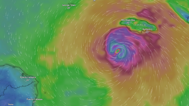
As of late Monday, October 27, all eyes are locked on one critical question: When is Hurricane Melissa going to hit Jamaica? With the storm now at Category 5 strength and its movement slowing to a crawl, the situation is as urgent as it is dangerous. Based on the latest data from the National Hurricane Center (NHC), Jamaica Information Service, and live broadcasts from The Weather Channel and CNN, the clearest answer is this: Hurricane Melissa is expected to make its closest approach or landfall in Jamaica early Tuesday morning, October 28, with significant impacts beginning Monday night.
While the exact minute the eye touches land may shift slightly with the storm’s wobbling path, the impact timeline is already unfolding. The reality is, hurricanes do not arrive in a neat, sudden burst. Instead, they bring a slow, intensifying march of destruction that begins hours before the center reaches shore. In Melissa’s case, the slow pace is one of the main reasons this storm is so destructive. It gives each feeder band more time to dump inches of rain, tear trees down, and push rising tides further inland along the south coast.
By Monday afternoon, the outer rainbands had already begun hammering southern parishes with strong gusts, sheets of rain, and rapidly growing surf. As the storm inches closer, tropical-storm-force winds will evolve into hurricane conditions by late Monday night, especially in exposed parts of the south and southwest regions of the island. Wind gusts of over 120 mph are possible in elevated terrain, and the combination of saturated soil and prolonged rainfall increases the risk of deadly landslides, particularly in hilly or mountainous areas.
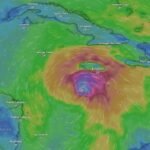
The most likely landfall zone is between eastern Westmoreland and western St. Elizabeth, according to official guidance from the Jamaican government. This puts the eye of the hurricane on track to rake across the southwestern coast sometime between 4 am and 10 am Tuesday, although significant effects will be felt well beyond those parishes. Melissa’s wind field is wide and its rainbands are dense. That means even northern and eastern parishes, including areas far from the core, will face serious weather conditions for hours.
What makes this storm even more dangerous is its slow movement, hovering at speeds under 5 miles per hour. That’s the pace of a slow jog, which means every square mile of the island it touches will spend more time under intense rainfall and wind. The NHC forecasts 15 to 30 inches of rain across Jamaica, with localized totals possibly exceeding 40 inches in mountainous regions. This is the type of rain that can destroy roads, isolate entire communities, and lead to major flash flooding. It also means swollen rivers and creeks could continue to rise long after the storm has moved on.
Storm surge is another immediate concern. The southern coastline, especially low-lying zones along St. Elizabeth, Clarendon, and Manchester, is at high risk for inundation from both surge and large waves. The NHC warns of storm surge levels reaching 9 to 13 feet above normal tides, especially east of the landfall location. These surges can easily sweep away vehicles, damage homes, and cut off access to major roadways. If you live in an area that has flooded in past storms, it’s very likely to happen again, only worse this time.
By Tuesday afternoon, as the core of Melissa begins to move away toward southeastern Cuba, the danger will not immediately end. Riverbanks will still be overflowing, and the tail of the system will continue to drop rain and churn up strong winds. Power outages are expected to be widespread, and recovery operations may be delayed due to impassable roads and ongoing weather threats.
Authorities in Jamaica have already opened shelters, issued evacuation guidance for flood-prone areas, and strongly advised residents to stay off the roads by Monday evening. If you are reading this on Monday night, the safest place to be is indoors, away from windows, with essential supplies within arm’s reach. Charge devices while you can. Stay tuned to local radio or emergency broadcasts in case of rapidly changing instructions.
It is essential to understand that even if Hurricane Melissa’s center misses your exact town, the hazards will still reach you. This storm is so large, so wet, and so powerful that nowhere on the island is truly safe from its effects. Flooding, mudslides, flying debris, and impassable roads are already happening in some areas and will worsen overnight. Whether you live on the coast or inland, in the city or the hills, now is the time to hunker down and ride it out.
Melissa will likely be remembered as one of the strongest storms to threaten Jamaica in recorded history. Whether it is officially listed as a landfalling hurricane or a close scrape, the damage will be the same. When you ask when is hurricane melissa going to hit jamaica, the short answer is now. The outer bands are already onshore. The eyewall may arrive early Tuesday, but the storm’s consequences are already here and will linger well into Wednesday. Don’t wait for the wind to knock. It’s already at the door.
Stay safe. Follow trusted local sources. Trust the official updates from the NHC and Jamaican authorities. CycloneRadar will continue tracking the latest developments as Hurricane Melissa unleashes its full force on the region.