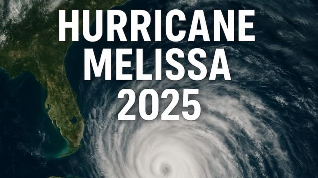
In the closing days of October, Hurricane Melissa 2025 formed quietly in the heart of the Caribbean. What started as a lopsided tropical disturbance on October 21 quickly turned into something far more serious. Warm sea waters, low wind shear, and a slow drift allowed Melissa to consolidate fast, spinning into a hurricane by October 25. While it isn’t the loudest storm on the map, it’s proving to be one of the most dangerous, particularly for Jamaica, southern Hispaniola, and eastern Cuba.
Melissa is not the type of storm that blows in and blows out. It’s a slow mover. A crawler. And that’s exactly what makes it such a threat. When hurricanes stall, rain piles up. Hills become rivers. Valleys turn into lakes. And in mountainous islands like these, flooding isn’t just water in the streets. It’s landslides. Washed-out bridges. Villages cut off by mud and debris.
By Saturday evening, Hurricane Melissa 2025 was sitting just south of Jamaica, still gathering power over very warm waters. The structure of the storm had improved fast. Satellite data showed a tightening core and strong banding features, with the possibility of rapid intensification still on the table. That’s forecast-speak for “this could get worse quickly.” And that’s not something you want to hear when a storm is already crawling across the region like a slow, heavy sponge full of rain.
What makes Hurricane Melissa 2025 especially dangerous?
There are three big reasons.
First, the rain. Tropical cyclones don’t need to be Category 5 monsters to be deadly. In fact, the slower they move, the more damage they do from above. In this case, Melissa’s pace is slower than a jog. At times, it’s only moving a few kilometers per hour. That means hours, even days, of steady downpours over the same terrain. Jamaica, parts of Haiti and the Dominican Republic, and even eastern Cuba are already seeing the impacts. Several outlets reported fatalities linked to landslides before the eye of the storm even formed.
Second, the surge. When a storm moves this slowly, it has more time to push water toward the coast. The south-facing shores of Jamaica, along with parts of Cuba and Hispaniola, could see significant coastal flooding, especially in bays and low-lying areas. The National Hurricane Center has already issued watches and warnings, and local governments are not waiting. Shelters have been opened. Flights adjusted. People urged to get to higher ground if they live near water or steep slopes.
Third, the wind. While Hurricane Melissa 2025 isn’t a massive system, it’s compact and strengthening. As it consolidates, wind speeds near the center can jump quickly. Damage from wind might not be the headline risk now, but a direct or near pass over Jamaica or eastern Cuba could bring gusts strong enough to topple trees, rip roofs, and knock out power for days.
What’s the forecast now?
As of Sunday morning, Hurricane Melissa 2025 remains a Category 1 storm with a high probability of intensifying. Some models even hinted at major hurricane status within the next 48 hours. The track keeps Jamaica close to the centerline, with a slow drift west-northwest expected. The tricky part is speed. If Melissa stalls or drifts unpredictably, the rainfall totals could double in certain areas. Even a 50-kilometer wobble north or south could mean the difference between manageable flooding and catastrophic disaster.
Looking ahead, the system might nudge toward eastern Cuba or the Cayman region, then potentially curve toward the Bahamas. It’s too early to tell whether Florida or the southeastern US will need to monitor Melissa, but for now, the real danger is in the Caribbean.
A human perspective on Hurricane Melissa 2025
Let’s be honest. Most people don’t follow hurricane forecasts every hour. It’s just another name, another cone on a map. But this one is different. Not because it’s the biggest, or the strongest, or the fastest. Quite the opposite. It’s quiet. Slow. Creeping. And that’s exactly why you should care.
As of now, Hurricane Melissa 2025 has already disrupted lives. Roads are blocked. Power is out in parts of Hispaniola. The rain hasn’t stopped in some places for over 36 hours. Forecasts show the storm could still gain more strength, especially if it maintains its compact structure over hot water. And while wind and surge will continue to threaten coastal towns, it’s the inland flooding and landslides that carry the highest fatal risk.
Governments across the region are responding. Jamaica has mobilized shelters. Eastern Cuba is under watch. Regional meteorologists are warning about flash flooding and structural collapse on unstable hillsides. It’s a moment where every hour matters. Every decision counts.
The 2025 hurricane season has been slightly delayed in its peaks, but Melissa is proof that it only takes one storm to change everything. Whether it’s your home, your harvest, or your access to clean water, these are the kinds of storms that reshape lives without ever needing to go viral.
For those in the path, now is the time to prepare. If you live in a flood-prone area, have a plan to move. If you’re near the coast, monitor surge watches. And if you’re outside the zone but care about the Caribbean, keep your eyes on Melissa. Share updates. Amplify local voices. Every bit of awareness helps.
Melissa may not be famous yet, but it’s the kind of storm that gets remembered. Not for what it looked like from space, but for what it did on the ground.