The Gulf is cooking, and Dexter could be next
There’s something brewing in the Gulf of Mexico, and its name might be hurricane Dexter by the time most of us finish lunch. This storm hasn’t earned its name yet, but it’s already catching the full attention of weather models, forecasters, and everyone living from Texas to the Florida Panhandle.
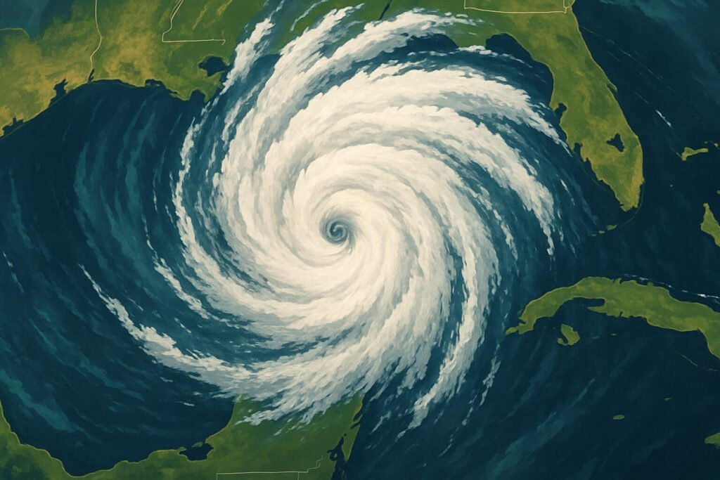
The system, currently known as Invest 93L, slipped off Florida’s west coast and into the Gulf with a pocket of deep tropical moisture and enough spin to raise eyebrows. Now it’s feeding on water temperatures around 30 degrees Celsius, with hardly any wind shear to disrupt it. That means this system has everything it needs to organize fast. Once it pulls itself together and sustained winds hit 39 mph, it’ll be named hurricane Dexter. If that happens overnight or early tomorrow, landfall could follow quickly.
Right now, most weather models agree on the path. They aim the developing storm toward the central Gulf Coast, targeting Louisiana or Mississippi for a Thursday night or Friday landfall. The timing, warmth, and moisture around it suggest that hurricane Dexter could become a tropical storm very soon, and possibly strengthen into a Category 1 hurricane before it reaches land.
But here’s the thing. The core of the storm hasn’t closed off yet, which is why official forecasts are still in “wait and see” mode. Once the center of Dexter fully wraps and begins pulling in strong convection, we’ll have a clearer idea of what to expect and how intense this will really get.
What’s ahead for Florida, Louisiana, and Texas
Florida has already been soaking under heavy rain from this system. From Tampa Bay to Gainesville, some areas picked up more than 8 inches in a day. That kind of saturation means even modest follow-up showers can cause new flooding. While hurricane Dexter is now moving away from Florida, the lingering moisture and tail-end bands will keep stormy weather around through Wednesday. Coastal Florida should also expect choppy surf, 4 to 6 foot waves, and stronger rip currents.
As for Louisiana and Mississippi, this is shaping up to be ground zero for Dexter’s landfall. The most recent model runs place the storm near Terrebonne Parish or the mouth of the Mississippi River, possibly brushing Mobile Bay depending on steering shifts.
What we do know is that the Gulf Coast is looking at potentially dangerous conditions starting late Thursday. Forecasts are pointing to 6 to 10 inches of rain for wide areas, with 15 inches possible in stalled bands. That much rain in a short time will trigger flash flooding, especially near rivers and in low-lying urban neighborhoods.
Storm surge is also a concern. Current guidance suggests 2 to 5 feet of coastal flooding depending on Dexter’s exact track and wind field. Inside bays, like Lake Pontchartrain or Bay St. Louis, those numbers can shift fast with minor track changes. Even a wobble of 20 miles could mean a bigger surge for one town and a lighter one for another.
Southeast Texas might not take a direct hit, but it’s not out of danger either. Beaumont and Port Arthur are positioned to receive several inches of rain if Dexter’s outer rain bands arc west. Combine that with the summer heat and pre-existing sogginess from recent Gulf storms, and you get conditions ripe for quick road flooding and urban runoff issues.
Could hurricane Dexter still surprise us?
Definitely. A few key factors could still shift how hurricane Dexter evolves:
- Wind shear: If the upper-level winds stay calm, Dexter will have the freedom to tighten its center and grow. But if shear picks up, the storm could become lopsided or struggle to strengthen.
- Eye formation: A storm with a well-defined eye tends to intensify faster. If Dexter closes off its core tonight or early Thursday, it could jump in intensity faster than expected.
- Stall near the coast: One wildcard in the models is a potential stall before landfall. If steering currents weaken, Dexter might slow down dramatically. That’s not good news. A slow-moving tropical system over warm water and soggy land can dump double or even triple the rain totals in some areas.
So yes, this storm could remain on the lower end of intensity. But it could also ramp up quickly if all the ingredients come together.
How to prepare for hurricane Dexter
If you live anywhere from the Texas border to Florida’s western Panhandle, now is the time to act. Here’s what you can do today:
- Clear your gutters and street drains. The biggest threat for many communities will be flooding, not wind. Even weak tropical storms have produced historic floods in recent years.
- Check evacuation zones. Use your local emergency management map to see if your home is in a surge-prone area. If you’re in Zone A or B, know where you’ll go and how fast you can get there if asked to leave.
- Charge your devices, refill any medications, and fill your gas tank. If hurricane Dexter strengthens and watches go up tomorrow, you won’t want to be stuck in last-minute prep traffic.
- Monitor official updates. The National Hurricane Center releases new advisories every 6 hours. These updates matter. The track and intensity cone might look the same at a glance, but small changes inside those updates can change your city’s risk profile in a big way.
Why Dexter matters in a warming season
This year’s Atlantic hurricane season is running hot, both literally and figuratively. The sea surface temperatures across the Atlantic and Gulf are well above average, which gives storms more fuel to grow faster. That means the time between tropical depression and hurricane keeps shrinking.
Dexter might end up being a Category 1 hurricane or just a strong tropical storm. Either way, it shows what forecasters have been warning about for years. Gulf storms are forming closer to land, intensifying more quickly, and delivering heavier rainfall.
Hurricane Dexter is also a reminder that the early stages of tropical systems are not to be ignored. It’s easy to look at an unnamed blob of thunderstorms and assume it’s harmless. But just 36 to 48 hours later, that same blob could be knocking out power and filling basements.
The takeaway?
Whether you’re in coastal Louisiana, southern Mississippi, southeast Texas, or the Florida Panhandle, this is the time to watch the storm closely. Hurricane Dexter could organize fast, and once it does, landfall won’t be far behind. Stay informed, stay alert, and don’t wait until the wind starts howling to get ready.

