The Eastern Pacific hurricane season has officially switched gears—and all eyes are on Hurricane Barbara. From a quiet tropical swirl to a full-blown hurricane in under 48 hours, Barbara is our first real reminder in 2025 that tropical systems can go from “eh, it’s forming” to “whoa, we better track this” faster than most people expect. So, where exactly is Hurricane Barbara now? What’s she up to? And is she going to slam into Mexico or fizzle out over open water? Let’s break it down in simple, no-nonsense terms.
From Baby Storm to Barbara the Hurricane
It all started on June 8, when a tropical disturbance off the southwestern coast of Mexico began organizing. Warm waters and low wind shear gave the system room to grow. By June 9, that developing swirl had upgraded into Hurricane Barbara, packing winds of around 75 mph and showing off a textbook core on satellite. She formed fast and strong—and for a short while, Barbara flirted with rapid intensification.
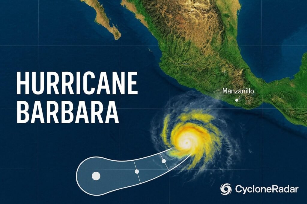
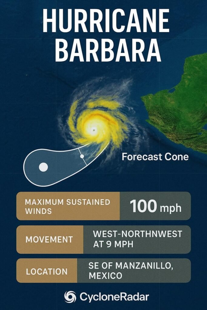
As of the latest updates, Hurricane Barbara is sitting about 175 miles west-southwest of Manzanillo, Mexico, moving northwest at around 12 mph. That track? It’s a blessing. Rather than charging toward Mexico’s shoreline, Barbara is veering out into the open Pacific, far enough offshore to avoid the worst-case coastal impacts.
What’s Happening Right Now?
Here’s the deal: Barbara is a Category 1 hurricane, and she’s at or near her peak intensity. Her structure is solid but not invincible. Forecast models are lining up behind the idea that she won’t hold hurricane status for much longer. Cooler waters lie ahead, and wind shear’s already starting to chew away at her core. That means Barbara is likely to start weakening today or tomorrow—and fast.
But that doesn’t mean we’re totally in the clear.
Coastal Impacts (Even Without Landfall)
Even though Hurricane Barbara won’t make landfall, she’s already causing life-threatening surf and rip currents along parts of Mexico’s Pacific coast, especially in Colima, Michoacán, Guerrero, and Jalisco. Some of those regions are also seeing 2 to 4 inches of rainfall, with isolated areas catching more—especially near mountainous terrain. Flash flooding and mudslides are real concerns, especially in vulnerable areas.
No coastal hurricane watches or warnings are currently in place, but local weather offices are keeping a sharp eye on surf conditions. Swells generated by Barbara are dangerous, and even strong swimmers could find themselves in serious trouble near the beach.
The Forecast: Fizzle or Surprise?
So what’s next for Barbara?
Track:
Barbara’s taking a northwest to west-northwest path, guided by a ridge of high pressure to the north. That path takes her further away from Mexico, sparing the coast from her strongest winds.
Strength:
Peak strength is now. Over the next 24–36 hours, Barbara will weaken into a tropical storm, then degenerate into a remnant low. Most forecasters agree she’ll dissipate completely within three days. No threat to land after that.
Big Takeaway:
Hurricane Barbara is not a landfall danger, but she is still dangerous. Just because the eye doesn’t hit land doesn’t mean the storm doesn’t matter. Coastal flooding, rip currents, and inland rain-induced landslides are still very much on the table.
Why Barbara Matters (Even If She Fades Fast)
You might be wondering: why all the fuss over a storm that won’t even make landfall?
That’s the thing with tropical systems—landfall doesn’t determine the danger. People swimming at beaches or living in flood-prone villages don’t care if the center of the storm is 200 miles offshore. They care about the waves, the rain, and the river that might suddenly rise into their house.
Plus, Barbara is a reminder that June storms can get serious, fast. She’s the first named hurricane of the Eastern Pacific season in 2025, and she hit hurricane strength early. That could signal a more active season ahead, especially if ocean temperatures remain warm and upper-level winds stay favorable for development.
What to Watch Next
If you’re in Mexico—especially near the coasts of Jalisco, Colima, and Guerrero—stay alert. The worst of Hurricane Barbara may stay offshore, but dangerous swells and flooding rains are a real concern. If you’re planning beach trips, keep tabs on local advisories. It’s not the time for surfing, swimming, or even walking too close to the shore.
Meteorologists are also watching the broader Pacific basin. There are a couple of tropical waves behind Barbara, and while none are threatening yet, it’s June. The season’s just getting started. Barbara may be the first, but she won’t be the last.
The Early Wake-Up Call
Hurricane Barbara might be on her way out, but she’s made her presence known. She spun up fast, avoided landfall, and still managed to stir up dangerous waves and heavy rains. That’s the kind of storm we can’t ignore—not because she’s the worst we’ll see, but because she reminds us of the power behind even a “minor” hurricane.
As we head deeper into the 2025 hurricane season, Barbara sets the tone: Don’t wait to take storms seriously. Even early-season hurricanes can disrupt communities, impact tourism, and test emergency systems. Stay informed. Stay ready.
If you’re in a hurricane-prone region, now’s the perfect time to check your emergency supplies, review evacuation routes, and bookmark trusted sources like CycloneRadar. We’ll be here with real-time updates, plain-English forecasts, and deep dives that help you understand what’s coming—not just what the weather models say.