The Florida hurricane season isn’t just a summer story. It’s long, hot, and edged with unpredictability. Officially it stretches from June 1 to November 30, but for Floridians who’ve lived through storms like Nicole, Wilma, or even Eta, the calendar doesn’t offer comfort. That closing date feels more like a guideline than a guarantee. Now that we’re in November, it’s tempting to think the danger has passed. The winds calm down, school returns to rhythm, and morning joggers greet each other under blue skies. But as the 2025 season has reminded us, Florida’s hurricane season still deserves attention through its final chapter.
Let’s start with the basics. Historically, Florida sees more hurricanes than any other state. Its exposed location, warm surrounding waters, and double-coastline geography all contribute to that brutal record. From the Gulf of Mexico to the Atlantic, there are just too many warm doors open. And although September tends to carry the highest risk, the tail end of the season often delivers surprise storms that form much closer to home. Think Caribbean, not Cape Verde. Think sudden, not distant.
November hurricanes in Florida are rare, yes, but they’re not impossible. In fact, the risk this month is low according to most forecasts, but not zero. That’s a key distinction. A recent report by Newsweek highlighted that Florida is still the most likely U.S. state to experience a tropical system in November 2025, even if those chances are slim. What gives Florida this unique lingering threat? It’s a mix of sea temperatures, geography, and climate signals. The western Caribbean remains very warm, while wind shear becomes more inconsistent. And then there’s the Loop Current in the Gulf, a kind of underwater jet of hot water that can supercharge a storm quickly. If a tropical wave taps into that and the upper-level winds cooperate for even a day, Florida is once again on the radar.
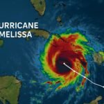
Nicole in 2022 was a wake-up call. It was a November hurricane, not just a tropical storm, and it made landfall in Vero Beach. The effects were widespread. Storm surge chewed up parts of the Atlantic coast. Heavy rain caused flooding in areas still recovering from Hurricane Ian just weeks before. That storm didn’t wait for textbook conditions. It formed close to home, in a familiar corner of the Atlantic, and proved that late-season systems don’t need a week’s notice to cause damage.
This season, Florida’s overall hurricane setup has leaned toward higher-than-normal activity. Warmer-than-average sea surface temperatures across the Atlantic, combined with La Niña conditions in the Pacific, created a supportive environment for more storms overall. While most of the major activity peaked in August and September, it’s those lingering conditions—especially in the Caribbean—that keep experts from fully relaxing in November.
Michael Lowry, a trusted meteorologist who writes in plain terms for storm-watchers and skeptics alike, explained it well in his seasonal breakdown. He describes two lanes of hurricane forecasting. One looks at broad seasonal patterns, like sea temperatures and El Niño or La Niña cycles. The other looks at short-term weather patterns: what the winds are doing this week, how fronts are moving, where moisture is pooling. The seasonal setup tells us if the theater is open. The short-term tells us if a play is starting. For Florida in November, the theater hasn’t closed yet.
So what should Floridians be watching now? It comes down to three main factors. First, keep an eye on the western Caribbean. That’s where many November storms are born. Second, watch for stalled cold fronts around the Bahamas or near South Florida. These fronts can help disturbances develop quickly. Third, monitor the Gulf. Even if the air feels crisp on land, the water is often still summer-warm below the surface, and that means fuel is available for any system that forms.
If a storm does begin forming in these areas, it usually develops faster than the long-traveling hurricanes of early fall. That means less time to prepare, and fewer clues from early satellite models. In other words, you can go from a quiet weekend to storm warnings in 48 hours. That’s why emergency managers across Florida continue to urge residents to stay ready through the end of the month. No need for panic. Just stay in the loop.
There’s also a climate layer to consider. Recent research shows that hurricanes are more likely to rapidly intensify today than they were a few decades ago. Part of this is because the oceans are warmer overall. Storms that would have taken days to build in the past can now reach dangerous levels overnight if they find the right conditions. This trend affects late-season storms too. Just because it’s November doesn’t mean intensification is off the table.
So here’s the simple takeaway: the Florida hurricane season is still active in November. Maybe not as busy as the earlier months, but still capable of producing a storm that matters. The pattern this year keeps Florida in the “low but not zero” category, and with warm waters nearby and a history of surprise landfalls, that’s enough to keep watching.
If you live in Florida, keep checking the National Hurricane Center’s daily outlook. Watch the western Caribbean. Stay alert when you hear talk of fronts dipping into South Florida or storms forming near the Bahamas. It’s not about worrying. It’s about not being caught off guard.
Remember, the Florida hurricane season doesn’t truly end until the last ember dies out in the Caribbean. That might be November 30 on the calendar, but the weather doesn’t care what date it is. One more storm could still find its way home.