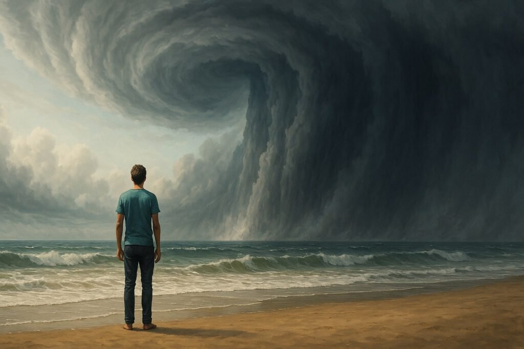
Whether you’re just starting to follow storm season or you’re deep into radar maps and spaghetti plots, every cyclone watcher needs a solid grip on the fundamentals. Understanding how cyclones form, strengthen, and spin isn’t just interesting—it’s essential.
Here are ten of the most important terms you’ll come across when tracking cyclones, explained in simple, no-fluff language.
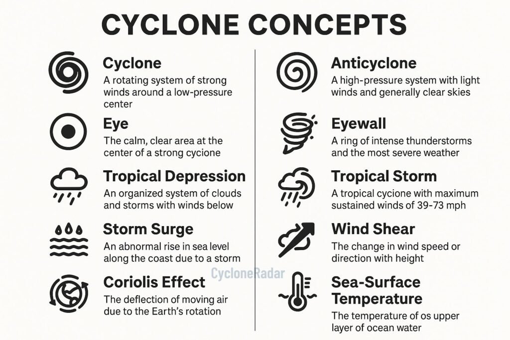
1. Cyclone (The Main Act)
Let’s start at the top. A cyclone is a big swirling system of clouds and wind rotating around a centre of low pressure. In the tropics, this often means heavy rain, thunderstorms, and damaging winds. If the winds get strong enough, it becomes a tropical storm—or eventually a hurricane, typhoon, or severe tropical cyclone depending on the part of the world you’re in.
The spin direction depends on where you are: counter-clockwise in the Northern Hemisphere, clockwise in the Southern Hemisphere. Think of it like a giant weather engine powered by warm ocean water.
2. Anticyclone (Cyclone’s Chill Cousin)
Where cyclones mean trouble, anticyclones bring calm. These are zones of high pressure where air sinks and spreads outward. You’ll usually get clearer skies and calmer conditions underneath an anticyclone. They rotate in the opposite direction from cyclones—clockwise in the north, counter-clockwise in the south.
They’re a big deal too. Anticyclones can block cyclones from moving or steer them in unexpected directions.
3. Eye (The Calm Inside the Chaos)
Ever seen those crazy satellite shots with a perfectly round hole in the middle of a storm? That’s the eye. It’s a pocket of light wind and sometimes even blue sky surrounded by intense weather. Not all cyclones have an eye—only the strong ones, usually when sustained winds hit 74 mph (119 km/h) or more.
Inside the eye: strangely peaceful. Around the eye? Absolute chaos.
4. Eyewall (Where It Gets Brutal)
Wrapping around the eye is the eyewall, and this is where things get intense. It’s a thick ring of towering thunderstorms that packs the cyclone’s strongest winds and heaviest rain. When a cyclone makes landfall, the eyewall is the part that does the most damage.
It’s the zone no one wants to be in—but storm chasers? That’s exactly where they head.
5. Tropical Depression (The First Warning)
All cyclones start small. A tropical depression is the baby version of a tropical cyclone. It’s got spinning thunderstorms and a closed circulation pattern, but the wind speeds are still pretty low—below 39 mph (63 km/h). It’s a heads-up that things could get worse.
6. Tropical Storm (Time to Take It Seriously)
When wind speeds pick up to between 39 and 73 mph, we’ve got a tropical storm. These systems get names (like Beryl or Freddy), and they can already cause flooding, rough seas, and power outages—so don’t let the “not yet a hurricane” label fool you.
7. Storm Surge (The Silent Killer)
Storm surge is one of the most dangerous parts of a cyclone. It’s not wind or rain—it’s ocean water pushed inland by the storm’s low pressure and strong winds. Surge can raise water levels by several metres, flooding coastal towns even before the cyclone officially makes landfall.
It’s sneaky, powerful, and often the deadliest threat in big storms.
8. Wind Shear (The Cyclone Breaker)
Vertical wind shear is when winds at different heights blow in different directions or at different speeds. If it’s strong, it can rip a cyclone apart or stop one from forming. If it’s weak, the storm has room to grow.
Cyclones love calm, stable air. Shear? Not so much.
9. Coriolis Effect (Why Cyclones Spin)
You’ve heard Earth spins, but did you know that spin changes how air moves? The Coriolis effect bends wind paths due to Earth’s rotation. It’s why cyclones rotate and why they don’t form right at the equator—there’s not enough spin down there.
Without Coriolis, no cyclone could organize.
10. Sea-Surface Temperature (Cyclone Fuel)
Warm water powers cyclones. Once the sea-surface temperature hits around 26°C (79°F), you’ve got the perfect heat source to feed a growing storm. The ocean acts like a giant energy drink—warm water evaporates, rises, and creates thunderstorms that fuel the cyclone’s engine.
Hotter oceans? Stronger storms. That’s why sea temperatures matter so much in climate discussions.
If you’re just diving into the world of cyclones, these ten terms are your foundation. They’ll help you read forecast discussions, understand storm graphics, and know what’s actually happening inside those spiralling beasts we track from space.
Want to go deeper? Stick with us at CycloneRadar.com. We break down complex storm science into plain English, so you can stay informed, stay safe, and stay curious.