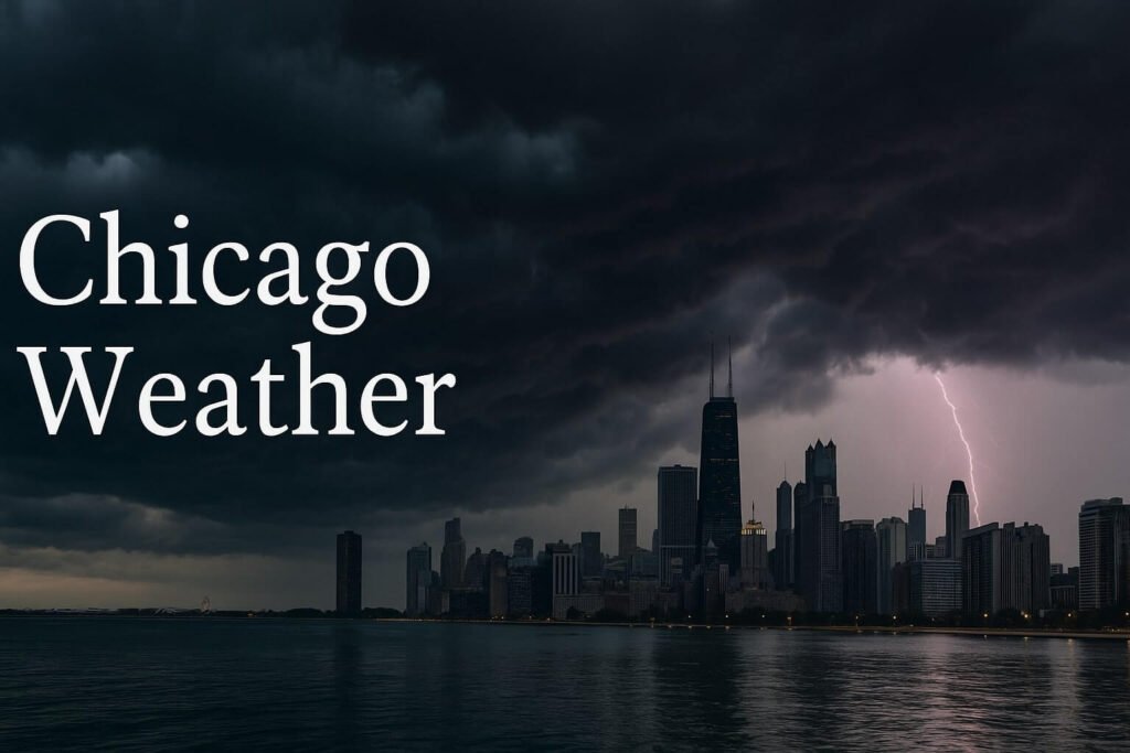
When Chicago weather decides to turn up the drama, it rarely settles for subtle. This week is a masterclass in that signature Midwest swing: part steamy sauna, part thundering light show, with a heat index you can almost see shimmering off the pavement. If you’re in or around the city this Friday and Saturday, you’re living in a tightrope act between summer joy and severe storm vigilance. With temperatures climbing into the upper 80s, sticky humidity in the low 70s, and a setup ripe for flash flooding, wind damage, and even isolated tornadoes, the atmosphere has no chill right now—literally or figuratively.
The keyword here is instability. Not just in the mood of the sky, but in the rhythm of daily life. That’s what happens when a warm front parks itself over northern Illinois while a stubborn low-pressure system barrels in from Nebraska, dragging along pulses of thunderstorm energy. These are not your gentle, sleepy afternoon showers. They come crashing in with 60 mph gusts, dime to quarter-size hail, and rainfall rates that could leave you stranded in under an hour.
Right now, multiple local alerts are already in place. A Flash Flood Watch is active across the metro area, highlighting the risk of overflowing drains, street ponding, and basement backups. The Storm Prediction Center has placed much of northeastern Illinois in a Level 2 (slight) severe risk zone, with elevated potential for organized lines of storms. With surface dew points pushing well past 70 °F and mid-level lapse rates indicating impressive instability, the chance for rapid storm development is as real as it gets.
But what makes Chicago weather particularly intense today isn’t just the heat or the thunder. It’s the overlap. The convergence of tropical air, lake-enhanced boundaries, and mesoscale features all hitting the city at once. Storms that start over I-80 this afternoon could tap into low-level wind shear and quickly evolve into damaging bow echoes or even discrete supercells. That means there’s more than one threat stacked on top of another.
If you’ve noticed your windows fogging, your AC groaning, and your dog acting weird, you’re not alone. The city is thick with pressure right now, and the atmosphere is looking for a release valve. By the time the sun dips below the horizon, we could be looking at lines of storms moving through the urban core, with rainfall totals climbing fast and power outages sparking across pockets of the city.
Of course, heat stress remains a parallel concern. With feels-like temperatures nearing 100 °F in some areas—especially when the sun pokes through those brief gaps in cloud cover—your body is working overtime. For anyone commuting, working outdoors, or even grilling on the patio, hydration is key. The combination of high humidity and ambient heat makes this weekend a real test for the elderly, young children, and those without adequate cooling.
Let’s also not forget the lake. While downtown’s shoreline can seem like a breezy escape when the inland heat builds, Lake Michigan can flip fast. When winds shift from southeast to northwest behind a storm complex, waves can kick up to 4–6 feet, with strong rip currents along both the Illinois and Indiana coasts. Already this summer, first responders have pulled multiple swimmers from rough water on what looked like sunny afternoons. Expect similar risks again this weekend, especially Saturday evening.
Sunday is shaping up to be the brief pause in the action. A weak ridge settles in, skies could clear for a while, and temperatures back off slightly into the low 80s. But it’s not the start of a new calm pattern. Early next week, more energy is expected to move into the region, recharging the thunderstorm threat on Monday and peaking again Tuesday. Chicago weather will remain volatile, with repeated chances for flash flooding and severe conditions through the middle of the week.
For now, it’s about awareness. Keep your phone charged and your alert notifications on. Check the radar before heading out, and avoid low-lying areas if the rain picks up. These storms can appear fast, dump rain harder than you expect, and drop trees or power lines in seconds. If you’re out during a warning, move indoors. If you’re at the beach, stay knee-deep at most when conditions are flagged. There’s no storm selfie worth risking your safety.
Let’s not forget this is part of a larger trend. Chicago weather in July has become more extreme in recent decades, with more 90-degree days, higher humidity, and heavier downpours. Urban flooding is now a familiar foe, especially in neighborhoods with aging drainage or limited greenspace. As climate patterns shift, so does our definition of normal.
So whether you’re heading out for Taste of Chicago, a neighborhood block party, or just your usual evening walk, today’s Chicago weather is asking for your respect. The skyline might still shine silver between the clouds, but behind it, the air is thick, the radar is glowing, and the atmosphere is preparing to speak loudly.
Stay alert. Stay cool. Stay safe.