It was early Sunday morning when Tropical Storm Chantal crept ashore near Litchfield Beach, South Carolina. By the time many in North Carolina were pouring their first cup of coffee, Chantal had already begun its slow inland march, dragging a wide, soaking, wind-tossed trail behind it. Although the center of the storm technically crossed the border from South Carolina, its most intense effects—flooding, gusty winds, and rip currents—were felt deep into the Tar Heel State. For residents and weekenders alike, this was a blunt reminder that even a moderate tropical storm NC can alter plans and rattle nerves.
A Sudden Spin Up, A Quick Landfall
Chantal didn’t waste time getting organized. It started as a tropical depression off the southeastern coast and gained tropical storm status in just a few hours. Fueled by warm Gulf Stream waters, it quickly consolidated and was named by the National Hurricane Center on Saturday afternoon. By early Sunday, Chantal had made landfall with sustained winds near 50 mph and began shifting into the coastal counties of North Carolina.
The storm didn’t roar in like a major hurricane, but it didn’t need to. The main concern wasn’t maximum wind speed—it was water. With a slow north-northwest crawl and deep tropical moisture feeding into the Carolinas, the storm dumped widespread rain totals of two to four inches, with isolated areas pushing past six inches. For cities like Fayetteville, Jacksonville, and even parts of Raleigh, this meant flash flood warnings and localized urban flooding before noon.
Flooding Risks and Flash Alerts
One of the most dangerous parts of any tropical storm NC event is how quickly conditions can shift. That was especially true this weekend. While early forecasts hinted at moderate rain, Chantal over-delivered. The bands of rain trained over the same regions for hours. In places like Anson County and the Cape Fear basin, heavy rainfall fell at one inch per hour, overwhelming storm drains and small streams. Some creeks in eastern North Carolina rose fast, like they had during Hurricane Florence and Idalia before.
The National Weather Service in Newport and Wilmington kept updating their advisories throughout the day, adding counties to flash flood watches and extending timelines. Emergency services warned drivers to avoid low-lying roads. In multiple locations, particularly rural areas, runoff from farmlands and already-saturated soil pushed ditches to the brim and caused temporary washouts.
Winds, Trees, and Power Outages
Chantal’s winds weren’t extreme, but they were persistent and sharp enough to do damage. Gusts of 30 to 40 mph were recorded well inland. At Sunset Beach and surrounding towns, wind speeds flirted with tropical-storm force even after the center moved north. The combination of wet soil and steady winds caused tree limbs to fall and shallow-rooted trees to tip. Power crews were already staged across the state and were quick to respond, but outages still peppered areas like Brunswick and Duplin counties.
Utility companies like Duke Energy had braced for this. Hundreds of workers were mobilized and trucks positioned from Charlotte to the coastal plains. Most neighborhoods saw only brief outages, but in wooded residential areas, especially where tree trimming hadn’t been recent, the risk of downed lines was higher than usual.
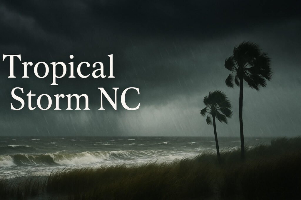
Surf Hazards and Coastal Warnings
Even though the skies started to clear by Sunday afternoon along some stretches of the coast, the ocean was not calming down anytime soon. Dangerous rip currents, strong shore breaks, and surf up to eight feet made conditions hazardous at beaches from Surf City to Kill Devil Hills. The National Weather Service issued rip current statements for all North Carolina beaches. Lifeguards ramped up patrols, and in several towns, swimmers were kept out of the water altogether.
These rip currents are deceptive. To beachgoers, the waves may look manageable, but the undercurrent can pull even experienced swimmers out to sea. After every tropical storm NC event, local officials have to re-emphasize that surf hazards often linger long after the storm has passed. Swell energy generated far offshore doesn’t dissipate quickly.
A Wider Look: Why Tropical Storm NC Still Matters
It’s easy to dismiss a system like Chantal as just a “rainy Sunday,” but doing so misses the point. The strength of a storm isn’t always in its category. For tropical storm NC situations, it’s the combination of steady rain, saturated ground, high winds, and poor drainage that creates real problems. This storm hit during a busy holiday weekend, when roads were full and campsites crowded. Several counties, including Brunswick and Carteret, had to activate emergency operations, distribute sandbags, and monitor flooded zones in real time.
It also exposed once again how vulnerable certain areas remain. Older neighborhoods with poor drainage saw flooding. Roads near creeks like the Little and Neuse flooded quickly. For families and small businesses, the cleanup may take days, even if the sun is shining now.
The storm also served as a wake-up call. The Atlantic hurricane season is just beginning. If Chantal spun up in 24 hours and crossed into North Carolina before most people even knew it had a name, what might a larger storm bring in August or September? Storm kits, backup power, flood insurance checks—these are things that should be done now, not in panic later.
What Happens Next?
As of Monday, Chantal’s remnants were expected to cross the Outer Banks and slide off into the Atlantic as a weakened trough. But that doesn’t mean North Carolina is in the clear. The air behind the system remains humid, scattered thunderstorms are still expected through the week, and soils are waterlogged. This sets the stage for any additional rain to quickly cause runoff or flash flooding.
Beachgoers should heed red flags and surf advisories for the next few days. Boaters are advised to stay in port until swells drop and visibility improves. And across inland counties, local crews will be inspecting roads, cleaning debris, and preparing for whatever the next wave of the season brings.
So while Tropical Storm Chantal may be winding down, the lessons it brought are fresh. Even smaller systems like this can disrupt lives, damage property, and stress emergency resources. North Carolina, once again, found itself caught in the crosswinds of a tropical system. The real success story lies in how people prepared, how fast warnings were issued, and how quickly communities will now recover.
Tropical storm NC events aren’t always headline grabbers. But they shape how people live, rebuild, and adapt in a storm-prone region that knows all too well what nature can deliver when the skies shift and the rain won’t stop.

